Handheld GPS or Smartphone for off-roading

DirtyMax88

Well-known member
I'm not sure this is posted in the right place, so feel free to move. I'd like to get people's (all you fellow Heartlanders that hit the trails too!) inputs/opinions on how they navigate the ORV/ATV/UTV trail systems across the US. I'm interesting in traveling and hitting unfamiliar places. I have been looking at some of the Garmins that have the nice displays and have tons of features. What's everyone using when they do their off roading? GPS or smartphones? I did notice that Polaris (which is what we have) has the ability to log everything to your smartphone, through an app. Now I don't know the ins and outs, but that seems very convenient. My concern with using a smartphone would be service. Some places are just in the middle of nowhere.....

Thanks in advance for y'alls input!

-Will
 
Last edited by a moderator:

ram22

Well-known member
You're right, wrong place, but I happen to do both, Heartland guy and KTM off-road. Get a Voyager. Made for OHV. Everything else is a work around. Voyager may even have wiring harness designed for your OHV.


Sent from my iPhone using Tapatalk
 

DirtyMax88

Well-known member
You're right, wrong place, but I happen to do both, Heartland guy and KTM off-road. Get a Voyager. Made for OHV. Everything else is a work around. Voyager may even have wiring harness designed for your OHV.


Sent from my iPhone using Tapatalk

I more so mean wrong place/topic in the forum, not on this forum. There way to many people on here that have Cyclones and Road Warriors (even people that don't have toy haulers) that off road alot, who I would love to hear from. I appreciate yours as well, Thank you. :)
 

BLR

Well-known member
We have a tablet mounted to the SxS
Down load maps for the area we are going to be in.
We use backcountry navigator.
Several maps to choose from, roads, elevations, Topo maps, FS roads, sites to see etc.

Sent from BLR Logistics
 

Lynn1130

Well-known member
Because we travel back-roads all over Arizona, dust becomes a major problem with an Iphone and I use both my Garmin 62ST and the Iphone for hunting and back-roading. The Garmin handles the dust fine but the small screen is difficult to read when driving so I use the Iphone, in a baggy and on a mount near the windshield of the Pioneer. Because I have the 7+ the screen is larger. The Ipad is too large and over some of the roads that we travel, gets way too much abuse. There are many maps available for the smart phone through the Avenza App including all of the forest service's multi use maps. Those maps as well as the others you download work like a GPS showing you on the map and in the case of the forest service, the maps show the roads that you can be on legally. Even topos available on Avenza work as a GPS on your smartphone. Also with the smartphone, I only have to carry one piece of equipment, rather than having, a GPS, a camera, a radio (although I do have my 2M/70cm handheld with me) and the phone works as the bluetooth connection between our helmet intercom/bluetooth connection. On top of that I plug the phone into a charging connection on the UTV so that it is charged during the entire trip. Oh, and Avenza is a free app. Some of the maps cost, but very little and most are free.

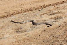
Diamondback has the right-of-way
 

Attachments

  • westerndiamondback.jpg
    westerndiamondback.jpg
    202.9 KB · Views: 37
Last edited:

LBR

Well-known member
Another great mapping resource is FOJ...Friends Of Jawbone. While the name sounds very limiting to the Jawbone area, they actually have ~10 maps of different SoCal and Az riding areas detailed out, and VERY NICELY done.

We currently have the Ridgefield/Dove Springs FOJ mapping and will toggle back and forth on the 8" tablet all the time between FOJ and BC.
 

wdk450

Well-known member
Signal wise cellular devices are probably more likely to lose signal in remote areas. Steep canyons can cut off some/all of the GPS satellite signals beaming down to your GPS, though. A GPS needs to receive signals from at least 4 satellites to work properly. There are currently 31 satellites in orbit around the world, 12,000 miles above the earth.
 

Lynn1130

Well-known member
Signal wise cellular devices are probably more likely to lose signal in remote areas.

They do, but if you download your map , like in Avenza, that does not become an issue. No system that depends upon sats or towers is perfect but I have been in some of the most remote areas of Arizona and have seldom had an issue since the map is on my phone or in my GPS but then carrying a paper map is always the backup.
 

wdk450

Well-known member
They do, but if you download your map , like in Avenza, that does not become an issue. No system that depends upon sats or towers is perfect but I have been in some of the most remote areas of Arizona and have seldom had an issue since the map is on my phone or in my GPS but then carrying a paper map is always the backup.

I guess it is actually ALL GPS satellite technology whether it is a GPS only device or a smartphone device. The smartphone devices all have to have a GPS receiver IC chip per law, for 911 emergency locating.
 

hoefler

Well-known member
I use a Samsung Tab A in my RZR with the GPS Waypoints Navigator. Uses GPS satellites to navigate. I have never had it fail on the trail hear in the Ozark Mountains or the Boston Mountains. I downloaded the maps off of the internet, and map/navigate the trails I ride. 90% of the tails I have riden have no cell service what so ever, it is so bad, I have to keep my phone plugged in to keep it charged.
 

DirtyMax88

Well-known member
Thanks everyone for their input. I appreciate it. I like the idea of using my smartphone, like someone said, you only have one device. I would definitely worry about the abuse it would take. Have any of you all used the Garmin Montana's? I know there are a few different series. I also like the idea of (whatever I'm using) tracking your routes, so you can see how far you went, elevation changes, etc, as well as using it to get back to base camp if need be.

Again, thanks for the input!

-Will
 

BLR

Well-known member
Love using the tablet also bigger screen area to see and can zoom in if needed we leave Turkey crumbs everywhere we go and we can overlay them onto another map or send/email the Turkey crumbs to other friends that maybe headed to that area.. Put waypoints in for special areas to visit or for future rides..
We have hit some big whoops/rocks in the desert and the Ram mount keeps it in place. Lot less money then a smartphone and more durable.. I had to have a smartphone replaced because of the bouncing.. when I turned it on I had a rainbow screen.. hehe

Sent from BLR Logistics
 

Lynn1130

Well-known member
I had a Garmin Montana, once, and for a short time, until it gave me wrong coordinates that I then sent to my son-in-law to locate me as I was standing over a downed elk. I then went back to the 60 series units. It may just have been that particular unit but I did not like the screen nor the fact that it gave me wrong info.

What ever you decide to use, and I have about 700 miles of very bad roads on this particular Iphone 7+ with no issues, a good software that will allow you to track, give you altitudes, and a wealth of other info, some of which you will probably not need if you don't hunt is "On X Hunt" by On X Maps. It does cost and the maps are by state but you can download the maps to your phone and not worry about dead spots.
 

DirtyMax88

Well-known member
..... a good software that will allow you to track, give you altitudes, and a wealth of other info, some of which you will probably not need if you don't hunt is "On X Hunt" by On X Maps. It does cost and the maps are by state but you can download the maps to your phone and not worry about dead spots.

I like the sound of that. I think this is the route I will go. After all, Polaris claims it has "the smoothest riding machines on the market," right?! :) So I won't have to worry about the rough trails... LOL. Thanks!
 

RonTimmer

Member
I think either does a good job at navigating, but I always bring a GPS along because if battery issues. I always seem to run out of battery when I use my cell phone. I have a Magelan GPS that uses AAs so I carry an extra set just in case. If you have or are going to put a power connection on your ATV this is not an issue.

Sent from my VS835 using Tapatalk
 

Gaffer

Well-known member
I use Avenza PDF map reader. Works with any geo-synched PDF map. The App is free and I have downloaded free maps from the National Forests, BLM and also timber companies with cooperative travel management plans for hunting units. All for free. Used this jeeping and hunting in Oregon, Utah and Arizona. You can track, name and save your routes. You can see your position with GPS coordinates. You can name and save points. You can measure distance between features on the map and much more. I like it. Check it out. Smart phone or tablet with GPS. No cell coverage needed.
 

wdk450

Well-known member
I think either does a good job at navigating, but I always bring a GPS along because if battery issues. I always seem to run out of battery when I use my cell phone. I have a Magelan GPS that uses AAs so I carry an extra set just in case. If you have or are going to put a power connection on your ATV this is not an issue.

Sent from my VS835 using Tapatalk

Regarding battery issues on the GPS's. The rechargeable batteries in the GPS's eventually go bad, and won't take a charge. New battery packs are available on E-Bay. I found that the case screws for my unit were hidden under the label on the back.
 

kf5qby

Active Member
I have a Garmin Oregon 400T that I use for trails and hiking. Small enough to carry comfortably and a decent size screen. Using external power keeps the battery from draining while trail riding.

I actually prefer to have paper maps and a compass. I use the GPS to spot check I am where I think I should be.
 
Top