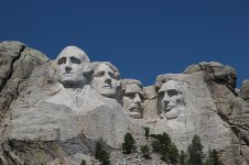
MT Rushmore

We will be going to Mt Rushmore pulling a Heartland Big Horn which is 13' 3" tall. We will be leaving the San Francisco Bay Area. Any recommendations on roads to travel and roads to avoid. Plan on taking I-80 to Cheyenne Wyoming, and not sure after that. Concerned about the height and overpasses.
Thank all of you in advance.


Sent from my iPad using Tapatalk
 

danemayer

Well-known member
We will be going to Mt Rushmore pulling a Heartland Big Horn which is 13' 3" tall. We will be leaving the San Francisco Bay Area. Any recommendations on roads to travel and roads to avoid. Plan on taking I-80 to Cheyenne Wyoming, and not sure after that. Concerned about the height and overpasses.
Thank all of you in advance.


Sent from my iPad using Tapatalk
Hy joecycle12,

Welcome to the Heartland Owners Forum. Mt. Rushmore is a popular destination, so I'm sure you'll get great advice shortly.
 

Piperflyer

Well-known member
Buy the Rand McNally Motor Carrier Atlas for truckers, has all the low bridges on every road in each state you can look up easily
 
Last edited:

Hogladyrider

Well-known member
We will be going to Mt Rushmore pulling a Heartland Big Horn which is 13' 3" tall. We will be leaving the San Francisco Bay Area. Any recommendations on roads to travel and roads to avoid. Plan on taking I-80 to Cheyenne Wyoming, and not sure after that. Concerned about the height and overpasses.
Thank all of you in advance.


Sent from my iPad using Tapatalk

FYI not sure when you plan on visiting Mt. Rushmore; we have been in Custer, SD since April 2017 workamping and the season is winding down. Many campgrounds close for the winter months and many attractions have reduced their hours of operation since Labor Day. There are a few campgrounds that remain open all year however be prepared for some colder temperatures.

Peak season out here is June, July, August and a great time to visit is right after Labor Day as families have returned home as the kids are back in school and the crowds have minimized.

It is a great area of the country, clean air, wide open spaces and a simpler way of living for sure!

Susan & Gary

Thank you for the very useful information


Sent from my iPhone using Tapatalk
 

JohnD

Moved on to the next thing...
Once you get to Cheyenne just follow your GPS directions . . .

Worked for us!

SDMtRushmore-IMG_0760.jpg
 

klindgren

Retired Virginia Chapter Leaders
We will be going to Mt Rushmore pulling a Heartland Big Horn which is 13' 3" tall. We will be leaving the San Francisco Bay Area. Any recommendations on roads to travel and roads to avoid. Plan on taking I-80 to Cheyenne Wyoming, and not sure after that. Concerned about the height and overpasses.
Thank all of you in advance.


Sent from my iPad using Tapatalk

We spent several weeks in and around Mt. Rushmore last year with our Landmark with no problems.
 

CoveredWagon

Well-known member
Buy a garmin LMT 660 And enter you dimensions. Add a few extra inches to the height though.
 
Last edited:

Bookoo

Member
I agree with the Garmin and the truckers atlas. I have both.

I am not pushing or representing any company or product, but my best information help is Trip Planner. Being new to Rv'ing, it has helped me not only with height restrictions but finding places to stay, fuel, dump stations, you name it.

If I have overstepped, I apologize.

I have the truckers atlas and GoodSam RV gps.I will look into the Garmin gps.
Thank you for the tips


Sent from my iPhone using Tapatalk
 

JohnD

Moved on to the next thing...
I've had my Rand McNally GPS for five years and like all of the RV features it has.

I am thinking about getting a new one with a bigger screen as the old eyes ain't what they used to be . . . :p

When we broke down on the highway in Phoenix I was able to locate several RV service centers within a couple of minutes.

Not only gave me the address of Sun City RV, but had the phone number listed along with details about their business.

SunCityRV-IMG_20150122_173556536.jpg
Us leaving Sun City RV at sunset the next day after temporary repairs were made so we could finish our trip and get home.
 

dave10a

Well-known member
The Interstates and major State hwy's are not a problem. I have traveled many of the state hwy's going to MT Rushmore with my rig and never had a problem. Have good trip and take your time-- there is a lot of beautiful country and historical venues to see and visit. Make sure your trailer suspension is well maintained.
 
Top